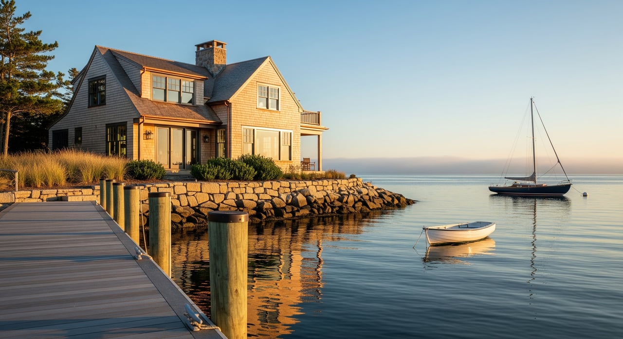
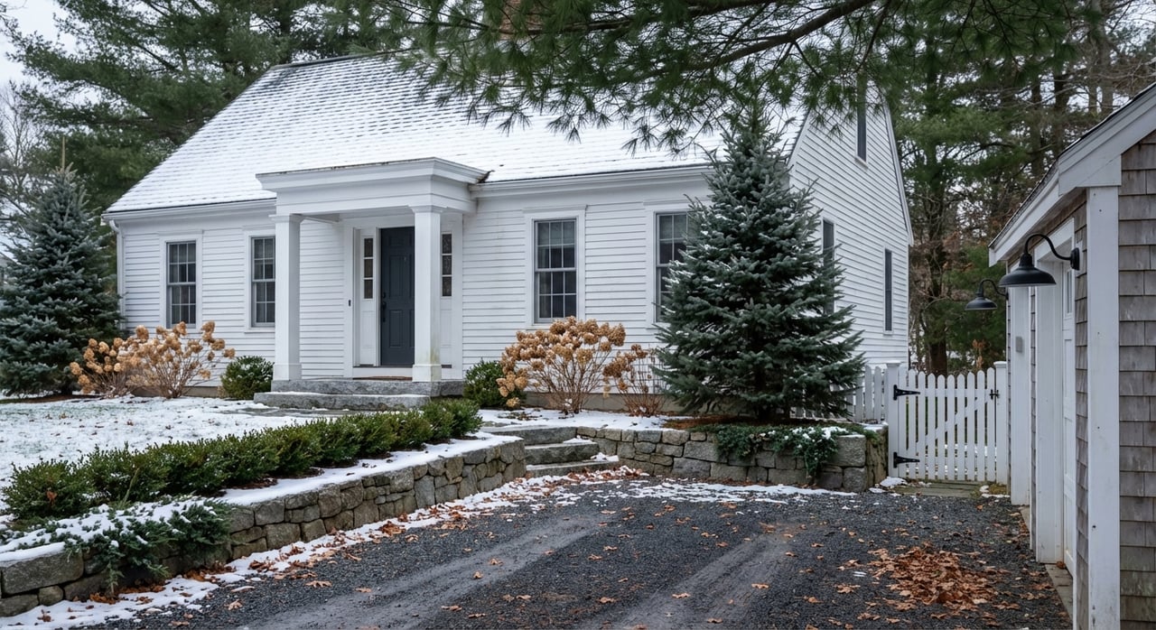
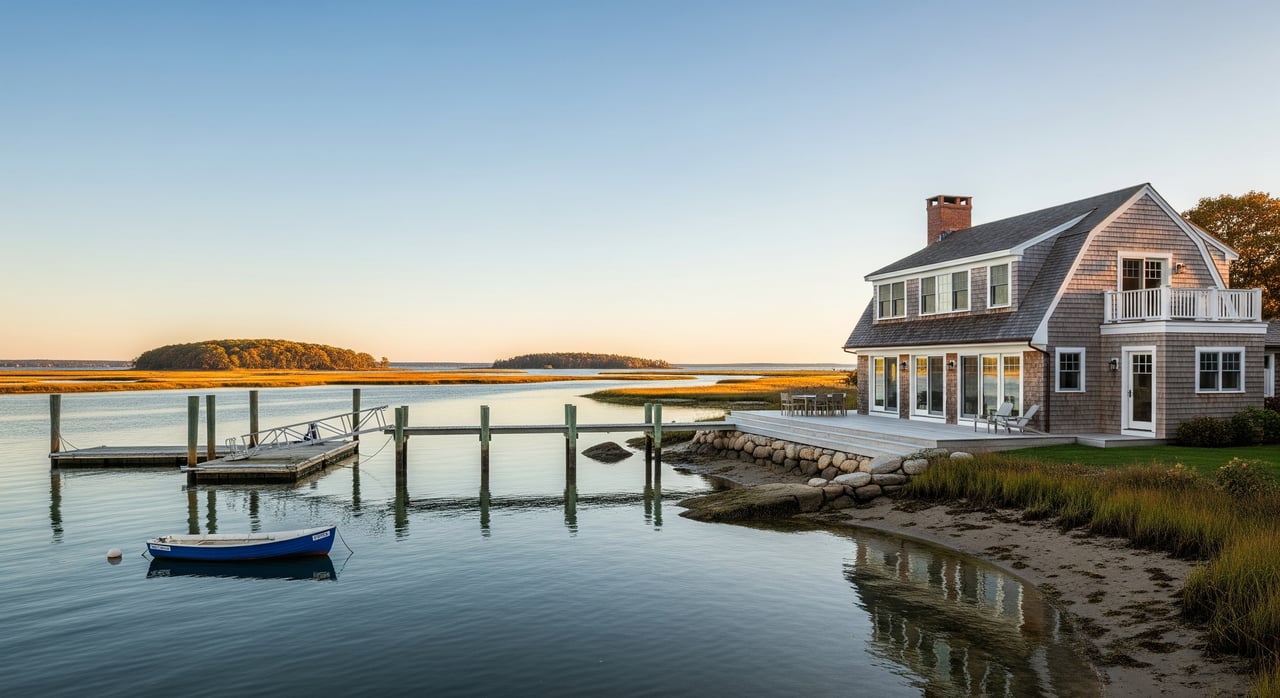
Coffee on the deck as the tide turns on the Damariscotta River sounds perfect. Buying waterfront here is different from buying inland though, and the details matter. With a little planning, you can enjoy the views without surprises at closing. In this guide, you’ll learn how local zoning, docks and moorings, flood risk, septic systems, and surveys work in Damariscotta and Newcastle, and how to vet a property with confidence. Let’s dive in.
What counts as waterfront here
Damariscotta and Newcastle sit on a tidal river system with saltwater influence. You will see a mix of settings and parcel types when you shop for property.
- Damariscotta River shoreline. Tidal water with changing water levels, intertidal flats, and access to downstream harbors.
- Harbors and coves. Tidally influenced areas that may offer deeper water and better boat access.
- Freshwater nearby. Ponds and streams exist in the region, though less common inside town limits, and often follow different rules than tidal waterfront.
- Common parcel types. Upland lots with private shore, marsh or intertidal frontage that reduces usable area, association shorefront, and properties with shared or private rights-of-way to the water.
Seasonal rhythms shape daily life. Summer brings more boating, shellfishing, and visitors, along with higher service demand. Damariscotta acts as a small regional hub, while many nearby roads and services remain more limited outside the village centers.
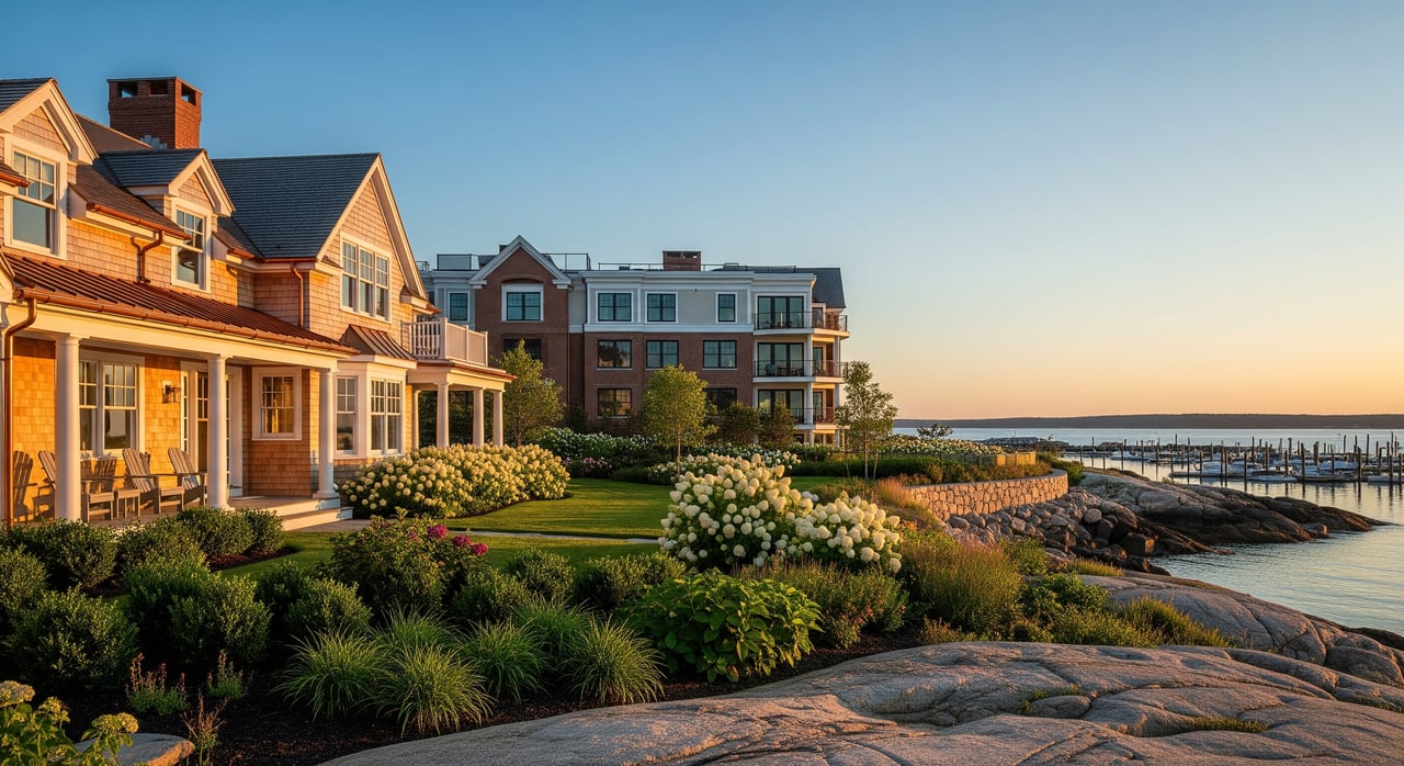
Buyer takeaway: waterfront carries a premium, and expectations often include boat access, scenic views, and privacy. Parcels with marsh or broad intertidal flats can be beautiful, but they may limit where you can build or place a dock.
Rules you must verify
Waterfront ownership involves layered jurisdictions. Owning upland along the shore is not the same as having unrestricted rights to build over tidal water. Plan to confirm rules with the town and state before you make an offer.
Shoreland zoning basics
Maine’s Shoreland Zoning law sets minimum standards that towns must enforce. Damariscotta and Newcastle apply these standards and may adopt more restrictive local rules. Typical topics include:
- Setbacks from the water
- Minimum lot size and shore frontage
- Vegetation clearing limits and buffer protection
- Impervious surface and lot coverage caps
Action step: call the town code enforcement or planning office to confirm the shoreland zoning district for the property and any local amendments that apply.
Property lines and mean high water
On tidal waterfront, the mean high water line is a key boundary for ownership and permitted use. A boundary or coastal survey that shows the mean high water line will help you understand what you own and where structures can go. Deeds may also include language about accretion, erosion, riparian rights, or rights-of-way. Ask your attorney and surveyor to review the deed and any recorded plans.
Docks, piers, and moorings
Owning shorefront does not guarantee you can build or keep a dock without permits. Depending on the location and design, you may need approvals from:
- Maine Department of Environmental Protection for shoreland and tidal wetland work, including docks and shoreline stabilization
- U.S. Army Corps of Engineers for certain structures in navigable waters
- Local harbor master under town harbor ordinances for moorings and local navigation rules
- Maine Department of Marine Resources for aquaculture and shellfish-related issues that may affect location or timing
Practical tips:
- Verify that any existing dock or float has current permits. “Grandfathered” structures still need proper documentation.
- Expect review for navigational impacts and potential neighbor or municipal comments.
- Ask about timelines, seasonal work windows, and any mitigation conditions that could add cost.
Riparian and access rights
Clarify whether the parcel provides private riparian rights and direct access, or if access is shared or via a right-of-way. Shared private drives and shore paths are common and should be recorded. Confirm the status, scope, and maintenance obligations for any shared access.
Septic and wastewater
Coastal lots can have site constraints like shallow bedrock, high groundwater, or limited area that complicate septic design. Maine rules require a site evaluation by a licensed designer and specific setbacks from water. On small or sensitive lots, advanced treatment systems may be necessary.
Ask for the septic design, as-built plans, and inspection history. If the system is older, budget for upgrades. Confirm the drinking water source and any well test results if applicable.
Environmental risks and insurance
Waterfront in a tidal river setting comes with unique risks. You should understand flooding, storm impacts, and how insurance works before you finalize your budget.
Flood zones and maps
Many waterfront parcels sit partly or fully within FEMA Special Flood Hazard Areas. If a federally backed loan is involved and the home is in the zone, flood insurance is usually required. Order an elevation certificate when appropriate and ask your insurer for quotes based on the Base Flood Elevation at the site. Ask whether the community participates in FEMA’s Community Rating System, which can influence premiums.
Storm surge and erosion
Tidal properties can face storm surge and long-term sea-level rise. A parcel’s exposure depends on elevation, topography, and proximity to open fetch. Identify any historical erosion, prior stabilization, or evidence of overwash. Living shorelines, which use vegetation and natural materials, are often encouraged where feasible, but each site is unique and requires permits.
Shoreline stabilization
Existing seawalls, riprap, and bulkheads typically trigger stricter permitting for repairs or replacement. Document the age and permit history of any structure. Expect agencies to consider softer alternatives before authorizing new hard-armoring.
Water quality and shellfish
Parts of the Damariscotta estuary support wild shellfish harvest and aquaculture. Closures can occur for water quality reasons. Owning upland does not confer rights to the subtidal bottom or to farm shellfish. Check for nearby aquaculture leases, municipal shellfish rules, or conservation restrictions that could limit new structures or certain uses.
Plain-language definitions
- Mean High Water (MHW). The average high tide line that often separates private upland from intertidal or public trust areas in tidal settings.
- Setback. The required minimum distance between a structure and a reference line like the shore or property boundary.
- SFHA. FEMA’s Special Flood Hazard Area where flood insurance is often required for financed properties.
- Elevation Certificate. A document that shows a building’s elevation relative to Base Flood Elevation, used to rate flood insurance.
- Mooring. A fixed anchor point in the water for securing a boat, regulated by local harbor rules.
- Conservation Easement. A recorded restriction that limits development or clearing to protect natural resources and may affect docks or additions.
Due diligence checklist before you offer
Use this quick list to organize your review. Confirm items in writing whenever possible.
- Ownership, title, boundaries
- Recent boundary survey showing MHW and any wetland or marsh areas
- Recorded easements, access rights, covenants, or conservation restrictions
- Any deed language about riparian rights, accretion, or erosion
- Permits and structures
- Copies of permits for docks, floats, ramps, seawalls, or riprap; confirm transferability
- Harbor or mooring permit process and current availability or waitlist
- Any past permit denials or enforcement actions on file
- Septic and water
- Septic design, as-built, inspection and pump records; known site constraints
- Drinking water source and any test results
- Flooding and insurance
- FEMA flood zone and Base Flood Elevation for the site
- Recent flood insurance quotes and any claim history
- Environmental and marine resources
- Proximity to shellfish beds, aquaculture leases, or seasonal closures
- Shoreline stabilization history and permits
- Any wetlands, marshes, or mapped habitat areas
- Access, utilities, services
- Year-round road maintenance status and any shared-road agreements
- Electric, internet, and trash services available year-round
- Neighborhood, rules, future changes
- Local ordinances or planned harbor or resilience projects that could affect use or value
- HOA or association rules, including shared shore access and costs
- Cost and financing
- Lender policies for high-hazard zones or nonconforming lots
- Estimated costs for permits, mitigation, or septic upgrades
- Seller disclosures and history
- Past permits, repair records, environmental reports
- Erosion or storm history and any shoreline management plans
Professionals to engage early
Waterfront deals are smoother when the right team is in place before inspections.
- Licensed Maine land surveyor with coastal experience locating MHW
- Real estate attorney versed in Maine coastal title and riparian rights
- Licensed septic site evaluator and designer
- Coastal or geotechnical engineer for erosion or stabilization questions
- Town code enforcement and planning staff for zoning and permit history
- Local harbor master regarding moorings and navigation rules
- Title company familiar with Lincoln County records
Documents and records to request
Gather these items during your contingency period so you can proceed with clarity.
- Current and prior deeds, recorded easements, and covenants
- Recent boundary survey showing MHW and any wetlands
- As-built plans for docks and shoreline stabilization
- Copies of all permits and approvals for shoreline, septic, and building work
- FEMA flood designation and any elevation certificate
- Septic designs, inspection records, and well water test results
- Any shellfish closure or aquaculture information relevant to the parcel
Smart buying strategy
- Start with zoning and boundaries. Confirm the shoreland district, setbacks, and lot coverage limits, then measure plans against a recent survey that shows MHW.
- Verify the dock reality. If a dock is important, review existing permits and speak with the town and, if needed, state and federal contacts about what is feasible at that location.
- Budget for resilience. Factor in flood insurance quotes, possible septic upgrades, and any shoreline management needs.
- Time your inspections. Coastal work often has seasonal windows. Build a realistic timeline into your offer to accommodate surveys, permits research, and professional evaluations.
- Keep an eye on future changes. Ask about planned municipal projects, harbor updates, or resilience efforts that could affect access, views, or navigation.
Next steps
If you want the beauty of Midcoast Maine without the guesswork, line up your survey, septic evaluation, and permit records before you negotiate. A calm, methodical approach protects your leverage and keeps closing on track. If you are weighing multiple shoreline options, we can compare zoning, flood exposure, and dock feasibility side by side to help you choose with confidence.
Ready to talk through a specific property or build a due diligence plan tailored to you? Connect with Adrianne Zahner to get started.
FAQs
What is the mean high water line on Maine tidal property?
- It is the average high tide line used as a key boundary in tidal areas, which helps determine ownership limits and where structures may require additional permits.
Do I automatically get a dock with waterfront in Damariscotta or Newcastle?
- No, docks and floats typically require permits from town, state, and sometimes federal authorities; always verify existing permits and feasibility before you buy.
How do FEMA flood zones affect a mortgage on a waterfront home?
- If the structure is in a Special Flood Hazard Area and you use a federally backed loan, flood insurance is usually required and is priced using an elevation certificate.
Who issues mooring permits in these towns?
- The local harbor master administers mooring permits under town harbor ordinances; availability and waitlists vary by location, so inquire early.
What septic issues should I expect on coastal lots?
- Limited space, ledge, or high groundwater can constrain design; a licensed site evaluator may recommend advanced treatment systems and specific setbacks near the shore.